Friday, July 30, 2021

August rain/temperature forecasts

Heading into the month of August and for most of the state, it is dry. Yet again, rainfall throughout much of July was very hit and miss, with many more areas getting missed than hit. Here's where we stand for the end of July on precipitation for the major reporting stations around the state:

As you look at the map, the areas in yellow or orange failed to get their normal monthly moisture. There continued to be heavy rains in eastern Kansas, so the need is not as widespread as what we are finding in central and much of the west.

August normals look like this:


August Temperatures (compared to normal):

I think the hottest part of our summer is behind us as we roll into August. I'm not saying we won't have a few hot days with highs near 100, but prolonged periods of it don't look that likely to me. We are going to start the month near to below normal (remember, average is 93), but things will heat up again as we get to our first full weekend of the new month. We've been lucky to escape major heat waves this summer, and August shouldn't be any different. 

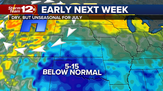
As we move into mid/late August, there's a chance we will be on the western edge of another batch of cool air that will be in the upper Midwest. 

August Rainfall:


Many areas of the state need rain. Fall crops are needing some water too, but don't count on August being a very wet month. While normal rain is about 3-4 inches in most places, that might be pushing it a bit for expectations in the weeks ahead. Our first week of the month won't have much rain, and the second week looks fairly dry as well. So whatever rains we get in August will probably show up mid-late month. Drought has expanded some in recent weeks, especially across central and southern Kansas and we may see more of that without much widespread rain coming our way. 

Have a good day & thanks for spending a few minutes here.

Tuesday, July 27, 2021

Heat wave is still on as smoke fills the air again

Thunderstorms that popped up Monday provided some nice relief from the heat and recent expanding drought. However, in typical fashion, it also frustrates those that didn't get a single drop and are now faced with waiting about another week. Storms were heaviest in Sedgwick, Harvey, McPherson, and Saline counties. You'll see in the sequence of slides below that radar was picking up on some localized 2-3" totals. As is often the case with summer storms, there's very little wind at higher altitudes to push the storms along, so they sit and rain themselves out, usually resulting in some hefty totals and flooding.

 
Smoke may be passing through Kansas... again:
  • The Elbow Creek fire in Oregon has burned over 22,000 acres
  • Dixie fire in Idaho is now at 38,000+ acres
  • Bootleg is now at 409,000+ acres
 All of that smoke is still moving through the northern Rockies and now heading south into the Plains. You will likely see smoky skies for at least a few days, then air quality may improve by Thursday/Friday.
 
Close call on a front - Friday:

It looks like a front may clip parts of north central and eastern Kansas Friday. Even if this front does meander into parts of our area, there is a HUGE high positioned right over the state, likely halting any chance of rain. Under high pressure, the air sinks, and that hinders the potential of getting rain. Some areas may see temperatures drop a bit, but 90% of Kansas will still be in the intense heat.

Weekend shift:

The expectation is that the upper high over Kansas will meander back south and west heading later in the weekend. That's a good start toward getting us some different weather into early August. Notice on the map that as we hit the end of the weekend, the high will be back in northwest Texas, hopefully allowing a front to start sliding through. 

It is just a snapshot in time, but just look at what one model indicates for Sunday afternoon around 3. 

Weakening the high pressure should allow for the rain chances to come back and hopefully there will be more chances for next week. It's premature to say what the aerial coverage might be, but here's a forecast for rainfall for Thursday - Monday (Aug. 2):


Next week won't be as hot. We should be back closer to normal highs (low 90s) for our first full week of the new month. Where has the summer gone?

Thursday, July 22, 2021

Just how long will this approaching heat wave last?

When you are staring down a 10 day forecast that has no rain and lots of hot weather, you're probably wondering "well how long is this going to last". Anybody that went through the brutally hot summers of 2011 and 2012 are probably a bit leery when things heat up with no end in sight. However, this summer hasn't been as rough on us as it could be - just ask those living in the northern Rockies and out across the West.

July so far has looked like this:

Big time cool from Chicago down to the southern Plains. The green colors represent average temperatures 5 to 8 below the norm. It is really remarkable how comfortable Kansas has been, especially with the humidity also down for several days in a row.

Much of Kansas has had more 80 days than 90s - south central Kansas (through July 21st) is just out of the top 10 "coolest" Julys on record.

This is next:

Forecast temperatures for the last week of July are HOT! As I mentioned in the last update, the big high pressure in the upper atmosphere that is driving the heat waves (and has mostly been west of Kansas) comes right over us. This means we will have a strong likelihood of hitting 100+. It will also be a herculean effort to get any storms to develop under the high - so for now, don't count on rain to finish off this month.

Does this last into August?
 
I wouldn't expect it to. Most models are showing a break down of the high in the central Plains and retreating westward heading into early August. That's also the time when we will begin to see better rain chances too. At this time, I don't think we are in for big rains in August, but we will have chances starting right at the beginning of the month. 

Saturday, July 17, 2021

The longest & hottest part of summer is comingde

There's no question, we have had some hot summer days this year and to date, here's where we stand on 100° temperatures in Kansas.

  • Dodge City - 7
  • Salina - 7
  • Goodland - 4
  • Wichita - 2
Most of those happened back in mid June as we continued to be in a very dry spell throughout the Plains. Late June, as you might recall, started to see some rain and temperatures backed down. 

Now, as we prepare to enter the last few weeks of July, a heat wave is developing and this may end up being the hottest stretch we will have for the remainder of summer. Most of the big heat this summer has been west of the Rockies. Take a look at what is going to happen. 

Roughly 18,000-20,000 feet above us, a large high pressure will to our west through the middle of the week:


Late week - weekend:
 

This large high pressure centers right up over Kansas. That means, our temperatures will go back above normal and possibly flirt with the century mark for several days. And to go along with it all, there will be almost no rain chance for about 8-10 days. I know there are still some very dry areas across our state that missed the weekend rains (or just didn't get enough). Bottom line is now, we will have to wait until the pattern changes again, which probably won't happen until right at the end of the month. 
 
We shouldn't be completely surprised given that our hottest point of the year is typically July 10-August 5th before the average highs start dropping into fall.
 

 Have a great week. Might be time to put the weather on auto pilot while high pressure slides through.

Thursday, July 15, 2021

Rain, a shifting heat wave AND why your cell phone may soon sound more alerts

Rain chances continue through Monday!!

I know we have many dry areas in Kansas waiting on rain. We are dealing with a stalled front that will stick around through the weekend AND we may still have some leftover rain on Monday. Some places could get a bunch while other areas may get enough to settle the dust. That's the challenge in making these forecast, but don't be too discouraged if the first round of rain misses you. Chances increase Saturday evening and again Sunday. The model forecast above takes into account weekend rains and what we might get Monday.

The seemingly endless heat wave that has covered much of the west this summer is about to shift once again as we head into our third full week of the month. The center of the high was located in Southern California for much of the past week, but it will move to Wyoming and the Northern Rockies in the coming days. As we've already seen this summer, that puts the hottest temperatures in places that are otherwise considered an escape from summer scorchers. 

Just look at some of the temperatures the models are predicting for Monday:

And Tuesday:

This is basically a repeat of what happened back in June when much of the northern Plains had record temperatures. 

Kansas will end up underneath of that huge heat dome - so we should have really nice weather for a good chunk of the week. Highs look to remain in the 80s. Just know that the setup for rain is NOT looking good for Kansas during the week. This kind of pattern should keep us rain/storm free. 

We could see the upper high settle into the central Plains down the stretch. Models aren't overly clear on how strong it will be, but I'd be preparing for the hottest weather of July arriving next weekend (July 23/24). I don't think it will be days and days of 100s, but this is a setup that will be looked at carefully as we get closer. 

More emergency alerting coming soon!! 

Those emergency alerts that hit our phones for Amber Alerts, Flash Flooding, civil emergencies, etc. will soon be increasing. Beginning July 28th (assuming you have the emergency alerting turned on), your phone will notify you if a "destructive" storm is approaching. This  means if the National Weather Service issues a warning for a storm producing 80 mph winds OR baseball size hail and you're in the path, your phone should sound the alert tone (regardless of what weather app you have) . You do have the option to turn these off, so you'll need to check your phone settings. Changes like these sometimes catch people by surprise, so let us know if you have questions. 

Tuesday, July 13, 2021

Storms on the horizon + more July "cool"

Nearing the halfway point of July and it has been remarkable to see how comfortable the temperatures have been in the Plains. It's too early to know if this will finish as a top 10 coolest July (most likely not), but when you have days in the 80s with low humidity, it's hard to beat. 

Dodge City July highs:

There have been 4 days with highs at or above average, including (1) 100° day. 

Wichita July highs:

Just one day... that is all... with a high temperature above normal. Part of that is due to the higher rainfall amounts at the end of June, helping to slow the warm up a bit. Western Kansas has been much drier as of late.

Setup for rain Thursday/weekend:

A front should stall over Kansas Thursday, bringing chances for storms and potential for locally heavy amounts of rain (central/southern Kansas). What tends to happen in summer is that upper level winds are weaker, so storms are slow to move. Severe chances aren't zero, but it's a lower of hail and wind.

Weekend: This setup looks like a nighttime round of storms forming on the High Plains of Colorado and Nebraska, then drifting on to the southeast and impacting a good portion of Kansas. My expectation is that Saturday night is the highest chance, with some leftovers still hanging around into Sunday morning. 

How much rain? Tough to say with high certainty this time of year because of the hit and miss nature of storms. However, I'm posting the image below just to show that everyone in Kansas at least has a chance of getting something, although it probably won't be satisfying for everyone. I know the fall crops need a drink, so cross your fingers for the coming days. 


Friday, July 9, 2021

Smoke arrives from the west & storms this weekend

You may notice some extra red in our sunrise and sunsets over the next few days/evenings as huge plumes of smoke come rolling in from western wildfires. A couple of fires in particular that are quite large include the Bootleg in Oregon that is 11,000 acres and only 1% contained. And the Beckwourth fire is in northeast California that has grown to 3800 acres.

The smoke plumes are quite visible on satellite images. The satellite pictures we are using here come from about 24,000 miles above the surface. Below, you'll see an image showing the smoke plume overlaid with the upper level winds (black arrows) that continue to carry it over the Rockies and down into Kansas. Most of the smoke will remain at high altitudes, but with some rain and thunder in the weekend forecast, it wouldn't be impossible for some of it to get carried down to the ground. 

Weekend storms: Best chance for severe weather Friday night will be in northern Kansas - wind gusts of 60-70 mph. The storms will track southeast. 

Saturday daybreak:

Whatever is on radar at the start of the day should not be severe. It will mainly be showers with an occasional rumble of thunder. 


Severe chance setting up for southern Kansas Saturday evening:

Hail and wind threats will be elevated for those areas along and southeast of the Turnpike. It won't be around long, and I would expect by 7 or 8 pm, most will be down into Oklahoma, leaving us with some quiet weather into the night.

In the heaviest rainfall, amounts will be up around 1-2 inches, but that's probably not going to be on a widespread basis. We still have some very high humidity and it shouldn't be too hard for these storms to ring out some heavy downpours. 

2nd full week of July:

Still no sign of major heat. The upper level high pressure (which is where most of us don't really want to end up) continues to be in a weakened state and likely out in California for several days. This keeps Kansas in a position to have near or below average temperatures for the majority of the week. I'm also expecting us to have some more rain opportunities in the middle part of the week. Hopefully by then, everyone will be finished with the wheat harvest. 

Friday, July 2, 2021

July outlook is here - any major heat for Kansas?

Settling into July and the holiday weekend is here. We've been inundated with news of the heat wave across the northern Plains and the Pacific Northwest where the heat was responsible for nearly 80 fatalities. Often overlooked, heat is the number one cause of fatalities from weather events (yes, even tornadoes and hurricanes). We haven't had to worry about it around here thanks to some rain and a different weather pattern.

In 2020, July was near normal with respect to temperatures. There were no major heat waves in Kansas and the number of 100 degree days was limited across the state. On average, the hottest part of the year usually comes in late July. If you get to the end of the month with a map that looks like the one below, we should consider ourselves lucky. 
 
4th of July record book:

July temperature outlook:
There will be some hot stretches before the end of the month. In fact, the end of our first week of July looks rather warm (highs mid to upper 90s possible), but an extended heat wave for Kansas is very UNLIKELY. The large high pressure (or the heat dome) should remain west of us for a good part of the month, and that will keep temperatures from getting out of control around here.
 
My expectation is that we will go through some cooler than average weather as we head into the middle of the month. Just remember, in July with the "average" being about 92 or 93, this will likely mean mid 80s (which may not necessarily be "cool" for some of you)


July rainfall outlook: (near normal - probably NOT a super wet month)
Most of the state would expect 3-4 inches of rain in July and I think that's certainly achievable between now and the end of the month. Most of that will probably come in mid-late July, but as was the case back in June, some areas may get a bunch while other parts of the state remain drier. That's what happens with summer storms. The southern Plains is likely to remain wetter than normal and areas north of Kansas may be a tad wetter than usual. 

Blog History